Getting to the Start of the Mount Obama Hike, Antigua:
A car is required preferably a 4×4 to get to the base of the trails up Mount Obama.
If you are coming from St Johns drive South along Valley Road until you reach the village of Jennings, drive through the town remaining on Valley Road and just as you exit the main urban area of shops and building in the town turn left at the first bus stop and along a dirt track for another mile.
If you are coming from Jolly Harbour or the South of the Island travel North along Valley Road and just before you arrive into the town of Jennings turn right before a but stop and a long a dirt tack for another mile.
There is a clear grass area at the end of the road before a set of metal gates, you can park here and then carry on along the dirt track on foot to reach the start which is 300 metres further along on your right.
Step 1: Beginning by the Mount Obama Monument Stone
At the beginning you’ll find old farming equipment in remembrance of what the area was known for and a memorial stone for the naming of Mount Obama when it was changed from Boggy Peak on August 4th 2009.
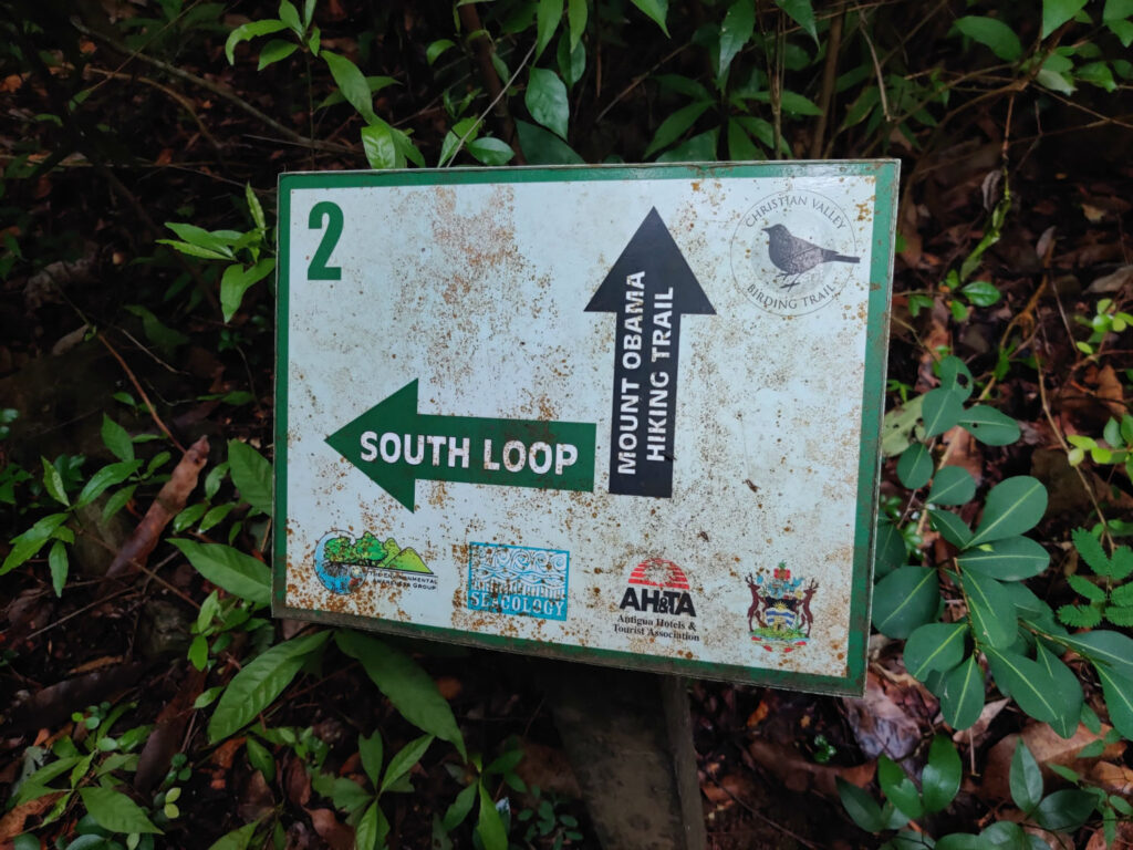
Head along the start of a trail going off into the undergrowth, it begins quite wide but very soon become a more narrow path. Keep following this until you get to a small sign with South Loop or Mount Obama Hiking Trail.

Step 2: South Loop & Mount Obama Hiking Trail Sign
At this sign keep to the right following the direction for the Mount Obama Hiking Trail. Walk along the trail for another 300 metres or so then you’ll come to another split at an area without any signs but each route is quite well trodden. Take the left path at this split (the right path takes you to a waterfall and is about a 30 minute diversion). Carry on until you come to a stream crossing.

Step 3: Stream Crossing
At the stream crossing head straight over and up the other side of the bank, do not turn right unless you want to follow the diversion to the waterfall. Keep following the path that leads a bit more into the forest and gradually turns right. The path remains reasonably flat for quite some time and then starts becoming more technical.

Step 4: Carry on upwards
The path will gradually become more inclined and become slightly more tricky to follow, take your time, check your GPS and stick to the main routes. You’ll pass through a few bamboo areas and the path will have some sudden drop offs to the right hand side that you need to be careful of.

Step 5: Keep Crossing the Streams
Along the path you’ll come across some running and some dried up stream, at all of these always cross directly over and do not follow the river bed. There may be some hanging tags along the stream but ignore these and stick to the main path all the time working your way round and up the peak.

Step 6: Final Push
Towards the end there are some more steep climbs but just keep going, you’re nearly there. You’ll start to feel the breeze as you climb higher and start to see the open sky on the right. After the final climb you’ll carry on straight for a short time then arrive at a T-Junction with another path.

Step 7: T-Junction Ridge Valley & Boggy Peak Trail Meet
At this T junction turn right to carry on up to the peak of Mount Obama, you’ll join a road in 30 metres and carry on the rest of your journey along this. From here there is only about another 15 minutes to the peak. The road is quite steep in places and is poorly surfaced if you were thinking of driving up instead.
If at the T-Junction you choose to turn left you’ll be returning to the start along the Ridge to Valley trail, more information on this later.

Step 8: At the Summit of Boggy Peak & Mount Obama
Arriving at the summit you’ll see the radio masts and main communication points for Antigua. These block out some of the best views but to the left is a small hut building with a mast you can climb up to get on the roof and get a better view of the island.
We must admit this is quite a let down and probably why this hike isn’t that popular as everyone wants to be rewarded with a wow view. However the hike itself, discovering the forest, winding your way through nature, is quite rewarding in itself and makes for an adventurous day out if you want to explore Antigua.

Step 9: Descending Mount Obama
Now you’ve done the hard work comes the knee wobbling part of working your way back down the peak. Carry on back downwards along the road the way you came and at the path section return back to the T-Junction you came to earlier where the two paths meet and make your choice:
Routes Down: Boggy Peak Trail
Turn left to return back down the way you came, for less experienced walkers we’d recommend this and you can enjoy it from a different viewpoint as you descend through the forest.
Routes Down: Ridge to Valley Trail
If you carry on straight where the paths meet you can return to the start via the Ridge to Valley Trail. This trail is very rarely used and it shows as you carry on further along it. Paths can be very hard to distinguish if they are there at all and it takes some skilful navigation to find your way back down to the start. Along it there are a few shoot off paths that lead to some mini summits and you’ll be able to glimpse a few more open scenic shots.
If you are to take this trail a GPS is a must with the route map of the Ridge to Valley trail to identify where to go when the path disappears. Towards the end there are a lot more steeper drops down the path which require care to navigate.
Routes Down: Follow the Road
Sadly you cannot return back to the start along the road, this road will take you to the South of the Island to Old Road. If however you are in trouble you could always go this way then call your hotel or guesthouse for collection. This trail can be hard to follow so have a good offline map software on your phone such as viewranger and download the map before the hike.
Enjoy your hike and share your photos with us! If you liked this content, check out our other posts about hiking routes around the world.
More Hikes in Antigua
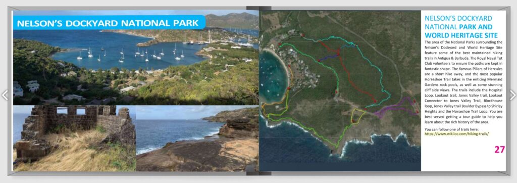
Download: Hike 365 Trail Guide
Explore a curated collection of Antigua and Barbuda hiking routes, from coastal walks to inland ridgelines, and download the official Hike 365 trail guide compiled by local hiking groups and volunteers.
This resource brings together the island’s most popular trails and practical trail‑planning tools in one place. The Hike 365 guide is a voluntary, community‑led e‑magazine produced by local hiking clubs and contributors, offering route highlights, trail maps, and tips for hikers of all levels.